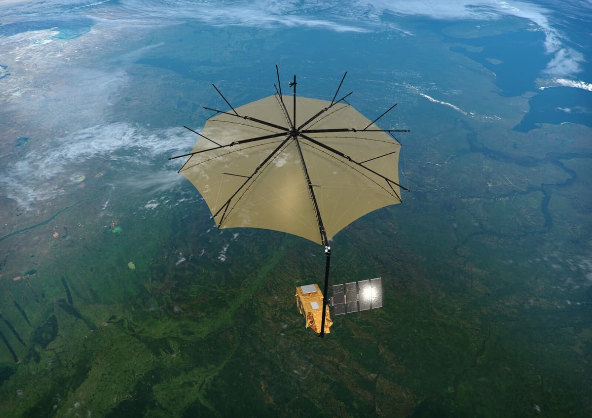
The satellite Biomass, which will be launched from Kourou in French Guiana on Tuesday, will be placed in orbit at an altitude of 600 kilometers. With the help of new technology that can penetrate tree canopies, the satellite will measure the biomass of forests, i.e. the total mass of all living forests across the entire planet.
"The goal is to understand how forests affect the climate and how climate change affects forests," says Lars Ulander, professor of radar remote sensing at Chalmers in Gothenburg, and one of the initiators of the project, in a press release.
Today's knowledge of how much carbon is stored in the world's forests and how it has changed over time is based on rough estimates that rely on indirect methods. With more accurate data, researchers can improve climate models and better understand the carbon cycle.
The satellite will continuously create global maps that will enable climate researchers to track changes and developments in the world's forests.
The first maps are expected to be available next year.
Launch: April 29
From: Kourou, French Guiana
Rocket: Vega-C
Orbit altitude: 600 km
Weight: 1.2 tons
Lifetime: At least 5 years
Unique feature of the satellite: Takes 3D images of forest biomass.
Source: The Swedish Space Agency