It is snowing heavily in Gävleborg County and the surrounding area. Several traffic accidents have occurred and SMHI warns of sleet, slippery conditions and limited visibility. The Swedish Transport Administration advises against driving there unless necessary.
"I advise people to take it very easy. Reduce your speed, keep a safe distance and don't do anything unnecessary," says Daniel Mossberg, press communications officer at the Swedish Transport Administration.
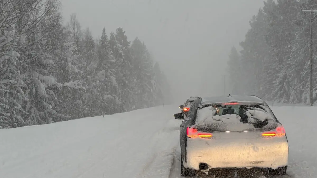
Late Tuesday afternoon, there was slow traffic and queues on the E4 in Gävleborg.
The area has previously received large amounts of snow that have affected traffic and power grids. Now SMHI is warning of another 10–20 centimeters of snow, locally up to 30.
"These are areas that have already been affected before, and it looks like there could be even more," says Max Schildt, meteorologist at SMHI.
Thousands without power
"The Swedish Transport Administration has all available resources out there to plow and combat slippery conditions. Heavy-duty trucks are also on standby next to the E4 north of Gävle," the authority writes in a press release.
In southern Hälsingland, all bus traffic is suspended until further notice "due to heavy snowstorms," X-trafik writes on its website.
The snowstorm is moving north from southeastern Sweden - where SMHI has also warned of snow. In Stockholm County, Södermanland and Uppland, 10–15 centimeters are expected.
"There are some remnants of the low-pressure system Anna, which affected southern Sweden with large amounts of snow over the past week," says Schildt.
During storm Johannes and the subsequent snowstorm Anna, over 70,000 households were left without power, mainly in Västernorrland and Gävleborg, reports Sveriges Radio Ekot.
On Tuesday, the electricity company Ellevio had just over 1,000 customers in Gävleborg who were still without power.
More coming soon
And it's not over yet. A new low-pressure system with heavy snow showers is moving in over the West Coast overnight. SMHI is warning of between 10 and 15 centimeters of snow, locally up to 25, starting Wednesday evening.
It then moves northeast across Sweden and reaches the central Norrland coast and inland on Thursday morning. A yellow warning for 15–20 centimeters of snow, locally 30 centimeters, has been issued for the area from Thursday to Friday.
"It will hit the Gothenburg area and parts of the West Coast quite hard on Wednesday morning, then ease off a bit during the day before picking up again on Thursday evening," says Max Schildt.
The storm is part of the low-pressure area that has caused hundreds of canceled and delayed flights in Western Europe.
"What's moving up over Sweden is perhaps its cousin, but it's not the same low-pressure center."
Here are all of SMHI's yellow snow warnings Tuesday–Friday:
Tuesday: Risk of locally heavy snow showers in large parts of Stockholm County, Uppsala County and Södermanland County. 10–15 centimeters expected. Snowfall will ease off Tuesday evening but may linger closest to the coast.
Tuesday–Wednesday: Patches of heavy snow showers in Gävleborg County, large parts of Dalarna, easternmost Härjedalen and southeastern Västernorrland County. 10–20 centimeters of snow, locally 30 centimeters. Snowfall will decrease in intensity during Wednesday afternoon.
Wednesday–Thursday: Occasional heavy snowfall in Västra Götaland County, Värmland and Örebro County. Snowfall is forecast at 10–15 centimeters, locally up to 25. It will start to ease on Thursday morning.
Thursday–Friday: Occasional heavy snowfall in Västernorrland, eastern Västerbotten, easternmost Jämtland and northernmost Gävleborg. 15–20 centimeters expected, locally up to 30.
Last updated Tuesday, January 6 at 2 p.m.